Travel to Canada
Day 4 Banff – Icefields Parkway - Jasper (291 Km.)
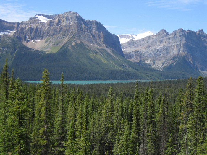
Bow Valley Parkway: We left Banff and go to the north through the Bow Valley Parkway first (an alternative to the scenic Trans-Canada Highway) and then along the Icefields Parkway (considered by some ones as the world´s most beautiful road) towards Jasper National Park. A day filled with spectacular views and with opportunities to view wildlife in the Rockies. We passed the Crowfoot Glacier, Peyto and Bow Lakes, and the Columbia Ice Fields.
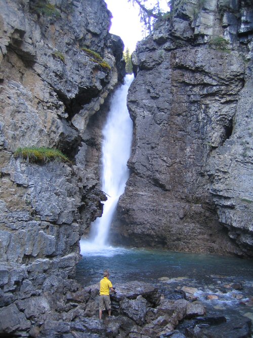
Johnston Canyon
About 25 miles from Banff, is the Johnston Canyon. A paved road leads up the canyon and its two waterfalls. The path (formed in some pieces for catwalks hanging on the wall of the canyon) to the lower falls can be visited in a wheelchair (1.1 kilómetros/20 minutes), while to reach the top (and five more tiny ) is required to climb a few steps (2.7 kilómetros/1h.). One of the most spectacular natural phenomena of the canyon are the Ink Pots, a series of blue-green pools where the water bubbles up due to underground springs. There are posters that explain the formation of the canyon.
Hector Lake
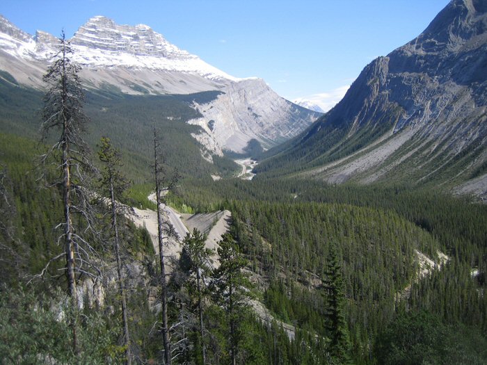
Icefields Parkway: This road was built during the Great Depression of the 1930s as a project to create employment. Designed to offer panoramic views, the road was expanded to its present size in 1960, giving it numerous seating areas to admire the landscape. This panoramic road of 230 km, runs from Lake Louise to Jasper, and winding among the cut peaks of the Rockies, offering a view at every turn even more incredible than the last.
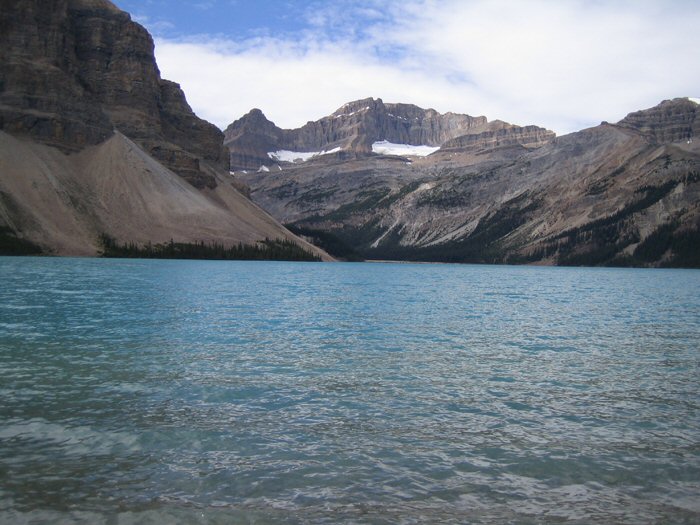
Bow Lake
After passing through the various viewpoints located on Lake Hector arrived at the viewpoint of the Crowfoot Glacier, 34 km. from Lake Louise. A century ago the glacier had three lobes, but since then the glacier has been melting and lost the bottom lobe and the middle lobe is disappearing too. It's an amazing extension of ice with the shape of a claw of a raven that hangs on the wall of a cliff.
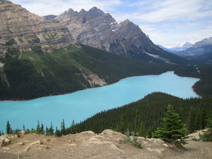
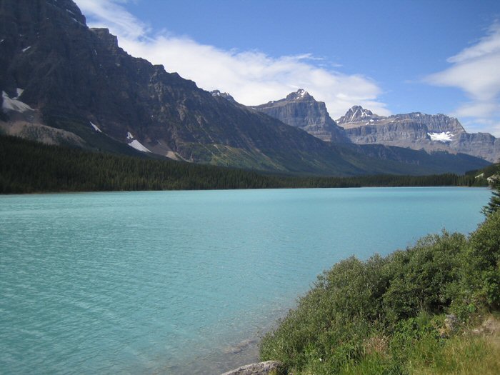
Peyto Lake
6 kilometers later we ascend to the Bow Pass, the highest mountain pass in this road, located at 2,088 meters above sea level. From this point a small road leads to the parking of the Peyto Lake lookout. From the parking a short walk leads to the Peyto Lake lookout. This glacial lake of turquoise waters, situated in the valley of the Mistaya river, compete in beauty with the Lake Louise. From the viewpoint can also be seen towards the left of the lake the Peyto Glacier.
Waterfowl Lakes
We advanced 32 km. more to the parking area of the Mistaya Canyon. From the road it took us 10 minutes to go down a path until the river Mistaya (then you have to go back the way uphill.) His raging waters formed this canyon by erosion, rounded stones on one side and forming potholes and a natural arch that joins the walls of the ravine. At the entrance of the canyon the valley opens up and can see some of the glaciers that fall on the Rockies.
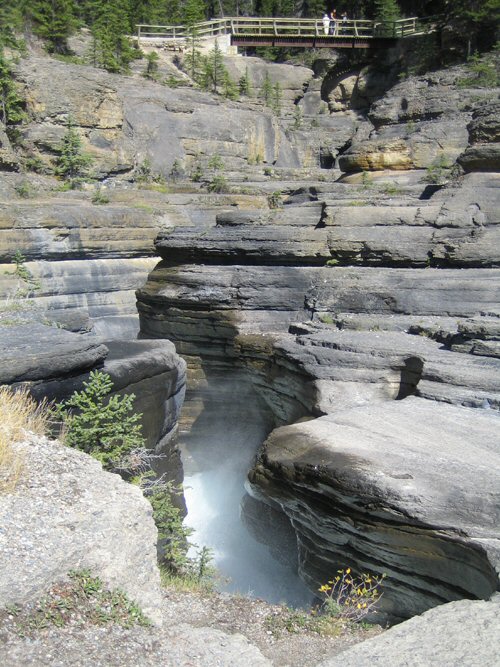
Mistaya Canyon
5 km. later (77 km. from Lake Louise) are the Saskatchewan Crossing. The Columbia Icefield, 326 km², is the largest glacier in the mountains and feeds three rivers: the Columbia, Saskatchewan and Athabasca. The ice fields continue north through the valley of Mistaya and then run through the channels of the North Saskatchewan River to the peaks of the Rockies. Just after this junction is a busy service area, as it is a crossroads and has the only petrol station in several kilometers.
Saskatchewan Valley
We done the last visit of the day to the base of the Athabasca Glacier, located at the edge of Jasper National Park. A path of 500 meters, located on the limestone that was under the glacier in the fifties, leads us to the base of the glacier. You must go sheltered because the glacial wind leaves you iced. Several interpretive signs explain the evolution of the glacier. You can walk on the glacier, but to avoid an accident must remain within the marked area. We arrived at Jasper to sleep.